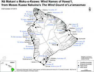
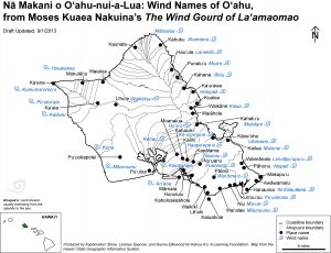
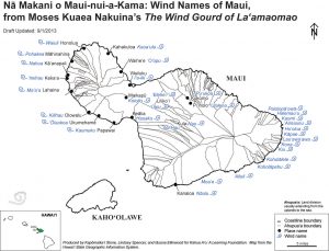
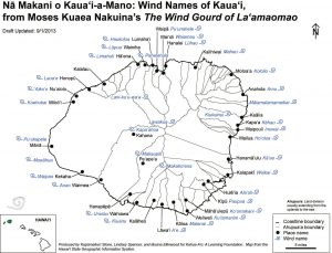
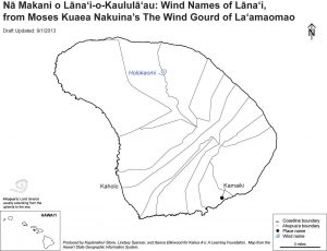
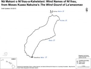
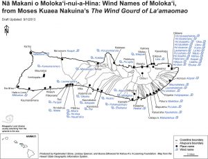
The Wind Gourd of La‘amaomao
During the collaboration with the Bishop Museum Education Department, the Kahua A‘o Wind Maps emerged from the Local Winds and Rain in Hawai‘i lesson as a visual aid for the Museum’s Science Adventure Center training.
Pre-existing maps of each island with specific place names relevant to the story were taken from the back of the La‘amaomao book, and the winds were placed in their respective areas. They were then digitally re-mastered using ArcGIS software, and thus the Wind Maps were born. They are an exciting re-articulation of traditional knowledge using current technologies and serve as a model for us to frame important knowledge in a visually concise and comprehensive way.