Hawai‘i’s Intertidal: Between Land and Sea
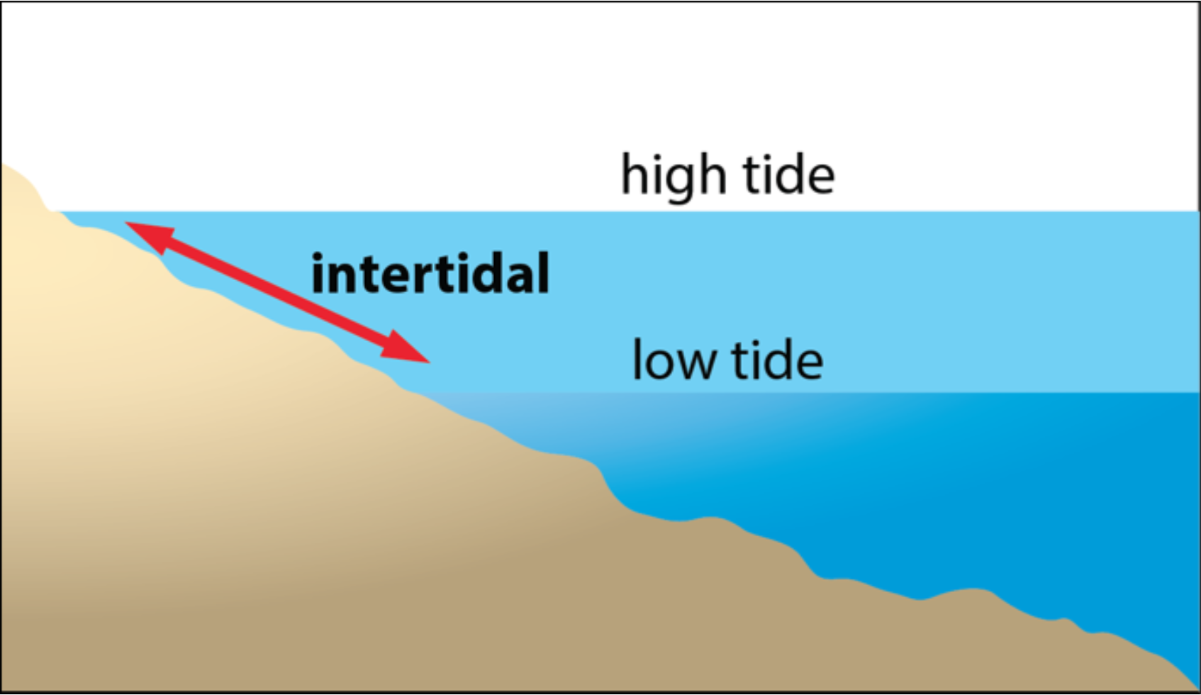
The intertidal is a unique coastal ecosystem that lies at the interface between land and sea. The intertidal is covered with water during high tide and exposed to air during low tide. Organisms that live in the intertidal are uniquely adapted for the challenges that come from being alternatively submerged and exposed. The intertidal is important in Hawaiian culture for food as well as for medicine and religious ceremonial purposes.
Unfortunately, the easy accessibility of the intertidal makes it susceptible to degradation by trampling and overharvesting. Due to its location at the base of the watershed, the intertidal is also affected by everything that happens upstream—from land-based pollution to development. In addition, its ecological position makes it vulnerable to threats such as species invasions and climate change, including sea-level rise and increasing sea temperatures.
Because of the cultural and ecological importance of Hawaii’s intertidal, it is a model habitat in which to measure ecological change. Monitoring provides a baseline from which to look at changes in species composition over time. Monitoring can also provide insight into factors responsible for observed changes, such as human impacts within an ahupua‘a—a land division extending from the uplands to the sea. However, the intertidal zones of tropical islands have been poorly studied, particularly in comparison to nearby coral reefs. This is especially true in Hawai‘i’s intertidal, where seasonal wave activity, a limited low tide window, and a modest tidal range mean the intertidal is often underwater or inaccessible.
About the OPIHI Program
Because of the cultural and ecological importance of Hawai‘i’s intertidal, it is a model habitat in which to measure ecological change. Monitoring provides a baseline from which to look at changes in species composition over time. Monitoring can also provide insight into factors responsible for observed changes, such as human impacts within an ahupua‘a—a land division extending from the uplands to the sea. However, the intertidal zones of tropical islands have been poorly studied, particularly in comparison to nearby coral reefs. This is especially true in Hawai‘i’s intertidal, where seasonal wave activity, a limited low tide window, and a modest tidal range mean the intertidal is often underwater or inaccessible.
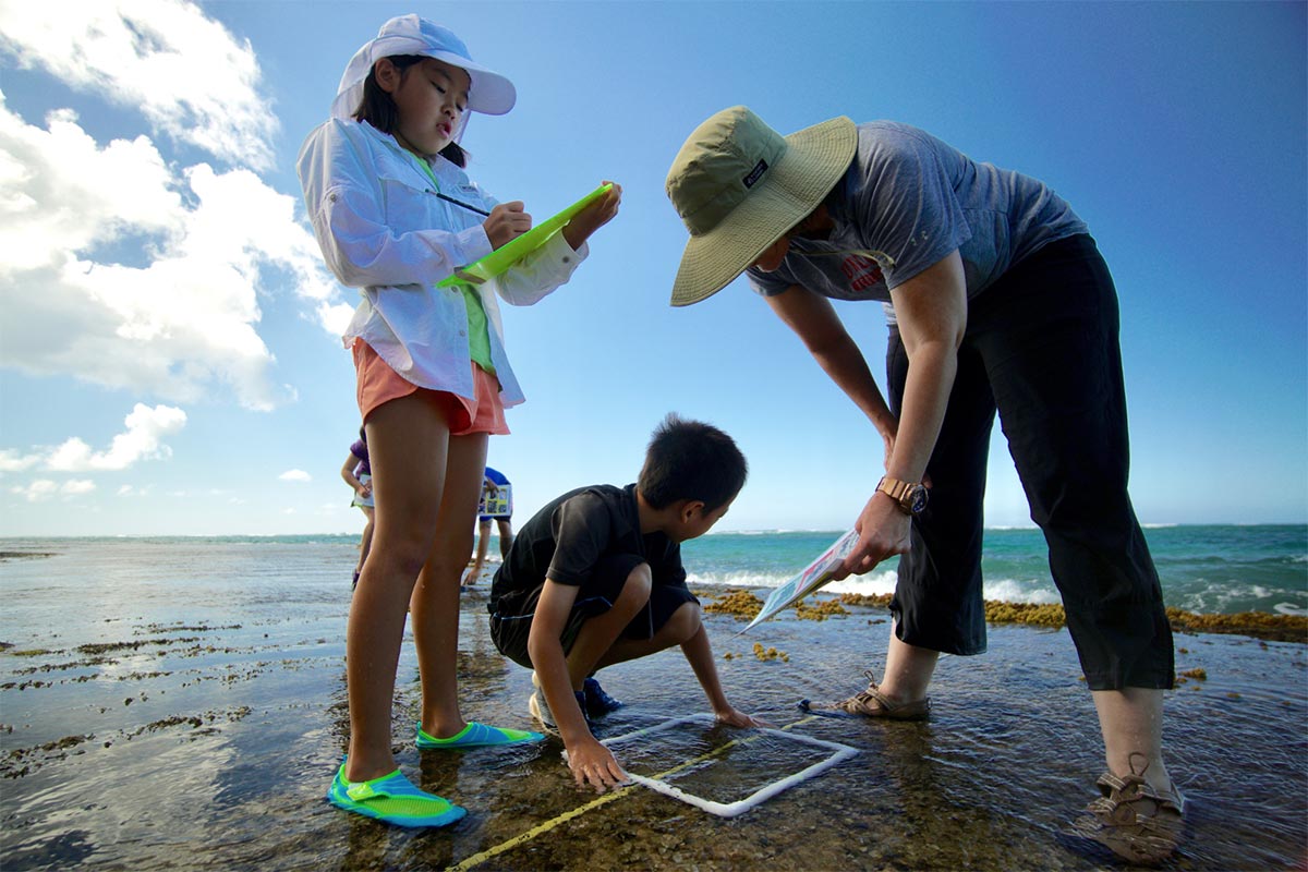
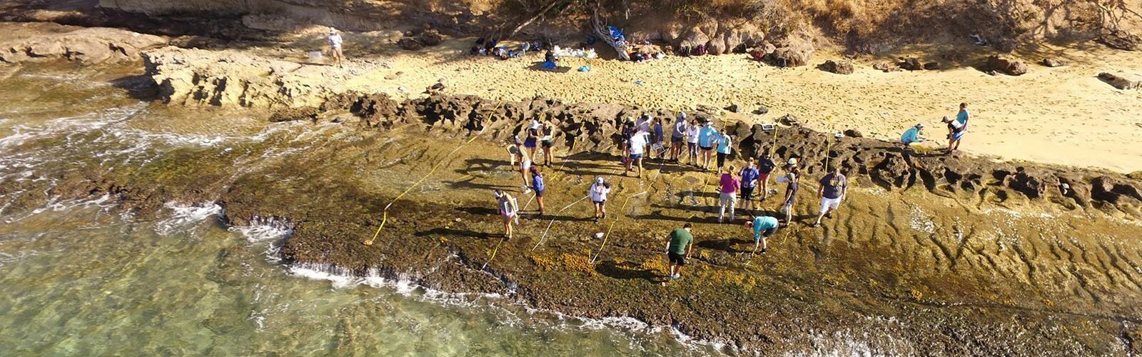
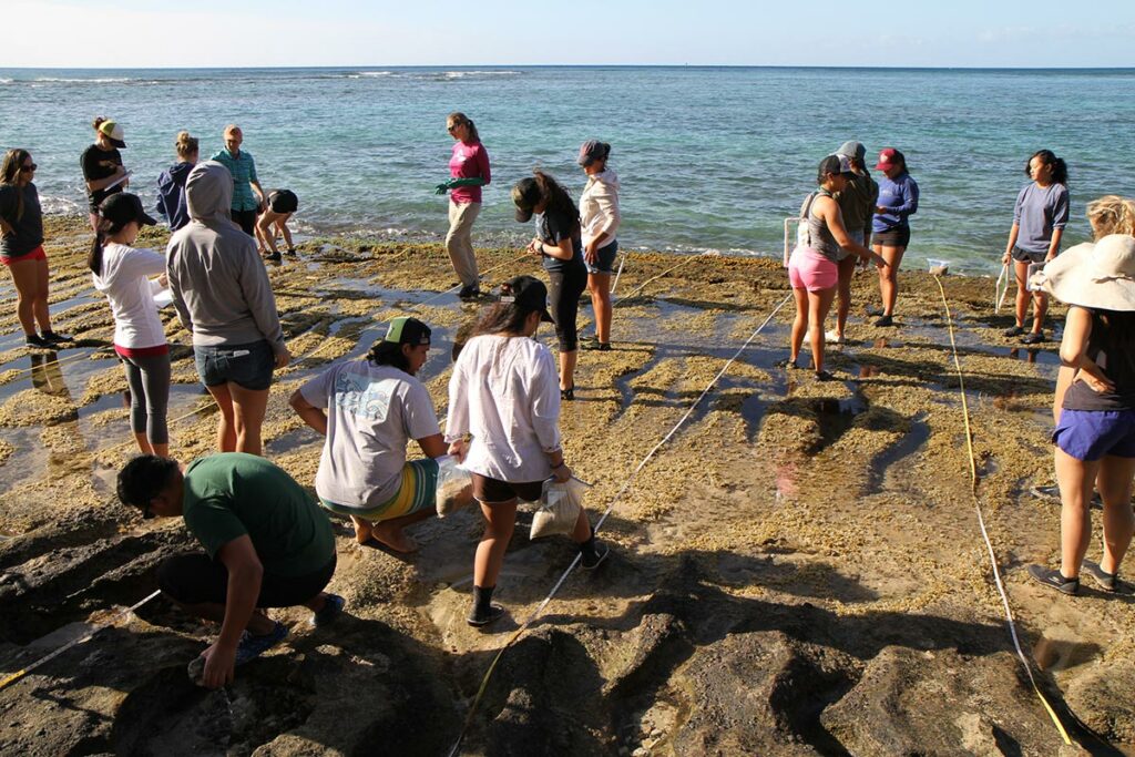
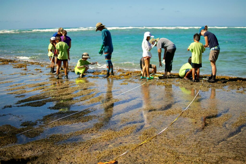
Ironically, the accessibility that makes the intertidal susceptible to human impacts also makes it ideal for citizen science research. Collecting research data can be costly, time-consuming, and labor-intensive—factors that can be offset by involving students in the data collection.
The Role of OPIHI
OPIHI has three major educational, scientific, and societal goals:
1) To enable participants to rigorously monitor intertidal regions in the Hawaiian Islands and contribute to our understanding of this understudied environment
2) To increase awareness and knowledge of the intertidal ecosystem in Hawai‘i and potential threats to that system by encouraging wise stewardship of our ahupua‘a
3) To improve participants’ knowledge of the scientific process by engaging them in authentic, place-based science research
Place and project-based programs like OPIHI make learning relevant. Participants connect knowledge across disciplines, engage directly with their local environment, develop a respect for nature, and prepare to be wise stewards—which helps them make better-informed decisions about environmental practices and sustainable resource use. OPIHI capitalizes on Hawai‘i’s unique geography by providing an opportunity for students to engage with the marine environment. Understanding the ocean is critical to the ultimate goal of increasing scientific literacy.